
Brownsburg Neighbors by Block
A block lookup combines sources because each one describes a different layer. The Town parcel map shows adjoining polygons and land attributes. The county roll names owners of record. Recorded plats establish lots and common areas. Planning files show public projects and hearings. Voter records have a separate legal route, while association rosters can remain private. Use the parcel number and legal description to keep those layers tied to the right land.
| Source | What It Shows About a Block | Access |
|---|---|---|
| Town GIS parcel map | Adjacent parcels, owner fields, lot, subdivision, zoning, flood, annexation and districts | Free public viewer and table |
| Hendricks XSoft roll | Owner, property address, class, neighborhood and district | Free county search |
| Recorder plats and declarations | Lots, easements, roads, common areas and association documents | Doxpop, archive or Recorder |
| Voter record | Individual status or a permitted dated county file | Name, birth date and county; file rules apply |
| Planning and community records | Hearings, project boundaries, association existence and public contacts | Town records, agendas and recorded filings |
An owner's mailing address can match the parcel address, but that still does not establish every occupant. Renters, relatives, guests, children, and protected residents may never appear. Describe what the source proves: ownership, adjacency, registration, a filing role, or a public contact.
Inspect Brownsburg Neighbor Parcels
The Town of Brownsburg Official Parcel Info Map accepts owner, parcel, address, and subdivision searches. Its parcel fields can include legal description, lot, acreage, utilities, zoning, flood area, annexation, TIF, and council district. Pan and zoom around the selected parcel, then use the map-extent filter to limit the table to the block. No true radius or buffer search was found.
The map's extra fields make it useful for more than names. A subdivision label can lead to a recorded plat. Annexation and district fields explain why two close parcels can follow different civic rules. Flood or utility fields describe land service, not a household. Export and table controls support a bounded parcel review, but they do not create a census of Brownsburg neighbors.
Note: Clear the map-extent filter before a new block search, or old map bounds may hide valid parcels.
Map a Brownsburg Block
Start from one verified address and walk only to parcels that share the visible block or touch its boundary. Record land identifiers first. Names can change, while the parcel ID, lot, subdivision, and legal description create a stronger bridge between the Town map, county assessment roll, and Recorder documents.
- Find the address in the Town parcel map. Confirm the selected polygon by parcel number and legal description.
- Zoom to the block and click each adjoining polygon. Record parcel, lot, subdivision, and owner-of-record fields.
- Cross-check each parcel in Hendricks County XSoft. Keep situs, which means the property's physical address, separate from the owner's mailing address.
- Use the subdivision and lot in the Recorder's plat or declaration search. Mark any boundary mismatch instead of treating every postal address as inside town.
For every parcel along a named road, use the Brownsburg street directory workflow. A neighbor search stays focused on the immediate block and nearby civic records.
Brownsburg Neighborhood Associations
Brownsburg's Unified Development Ordinance requires an owner's association for qualifying common areas and calls for declarations or covenants to be recorded. No official townwide association directory or public membership roster was found. The sound route begins with the subdivision name in GIS, then moves to the Recorder for the plat and declaration, and to INBiz or an official association site for a current public contact.
| Step | Official route | Useful result |
|---|---|---|
| Identify | Town parcel map | Subdivision, lot, parcel and common-area setting |
| Confirm | Hendricks Recorder or archive | Recorded plat, declaration, covenant or amendment |
| Contact | INBiz, planning file or official association source | Legal name and public agent or board contact |
Membership is a private relationship unless the group itself publishes it. Adjacency also does not prove association membership. The recorded instrument controls over a discovery map or an informal neighborhood name.
Watch Brownsburg Property Filings
The Hendricks County Recorder links Doxpop Property Watch, a notification route for recorded property activity. It is designed for monitoring instruments tied to property, not for compiling a list of Brownsburg neighbors. Deeds, plats, declarations, liens, and amendments can clarify ownership or subdivision governance after a parcel map supplies the legal identifiers.
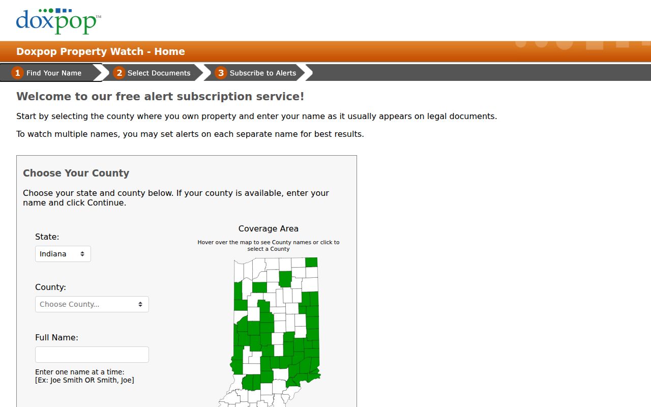
The signup screen is a reminder to verify the parcel or owner terms carefully. A notification reports a filing event; it does not prove occupancy or the meaning of the instrument.
Older plats and scanned Recorder books may also appear in the Hendricks County Archive Center. When an online image is missing, ask the Recorder about counter, phone, mail, or copy access by document number, book and page, or subdivision.
Brownsburg Block Meeting Records
Town agendas and meeting packets add public context around a block. A packet may identify a parcel, ordinance, public hearing, project boundary, zoning request, annexation, or development stage. Keep the meeting date and project status with the parcel number. A proposal is not an approval, and an approval may later be amended.
The Brownsburg Agenda Center provides the official route to these meeting records.
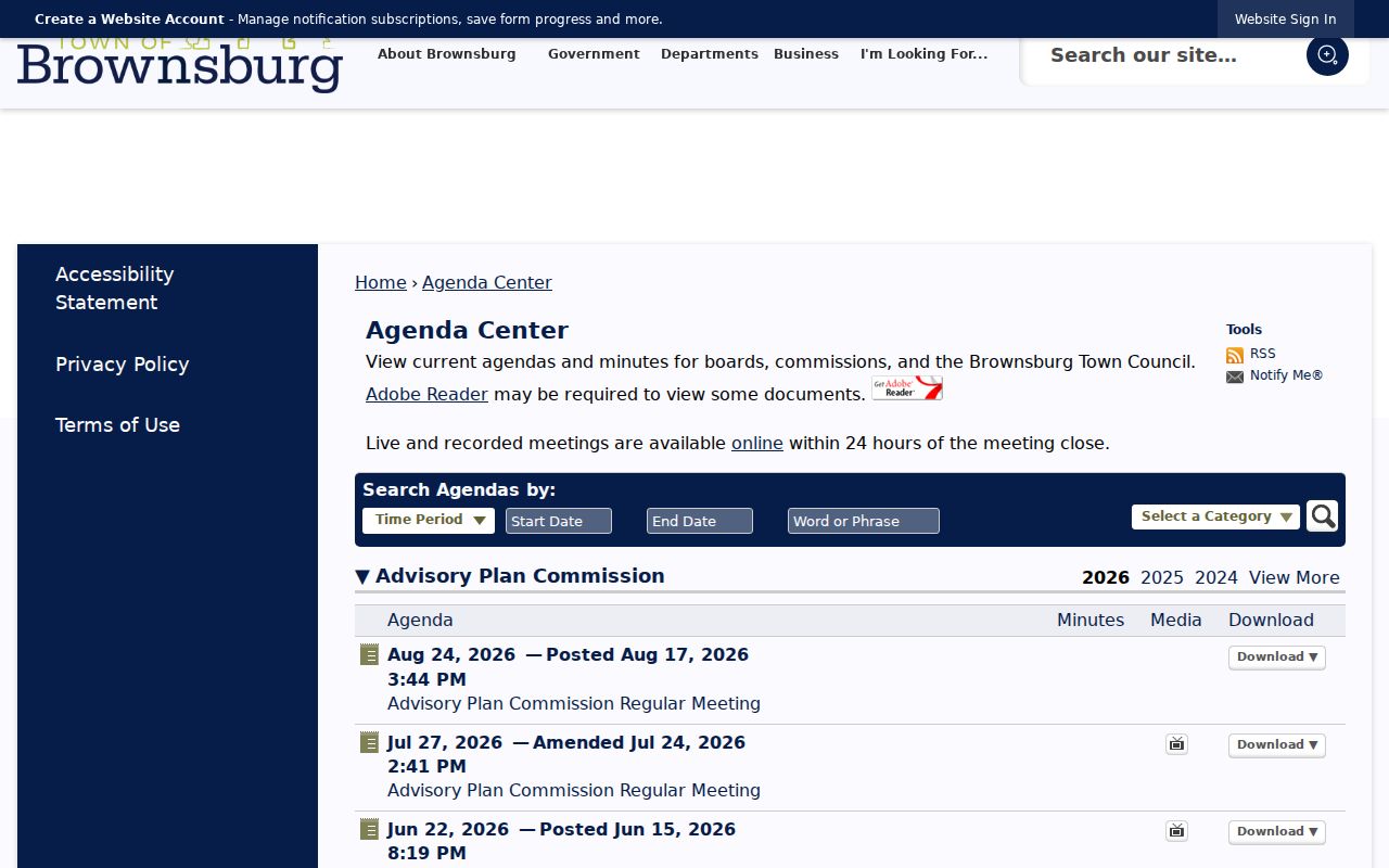
Use agenda dates and attachments to build a project chronology without assuming that a named applicant, owner, or speaker lives next to the site.
For a defined town permit, inspection, code, or planning record that is not online, use the Town Clerk-Treasurer public-records route under Indiana APRA. The portal inspected for permits requires an account, and no open address-keyed permit index was verified. A narrow request should name the parcel or address, record type, and date range.
Brownsburg Community Record Routes
Some block questions belong to a specific public body rather than the parcel roll. Fire Territory records, Town planning files, council packets, and voter-registration records have separate keepers. The Brownsburg Fire Territory records request is one official path for a defined fire-territory record.
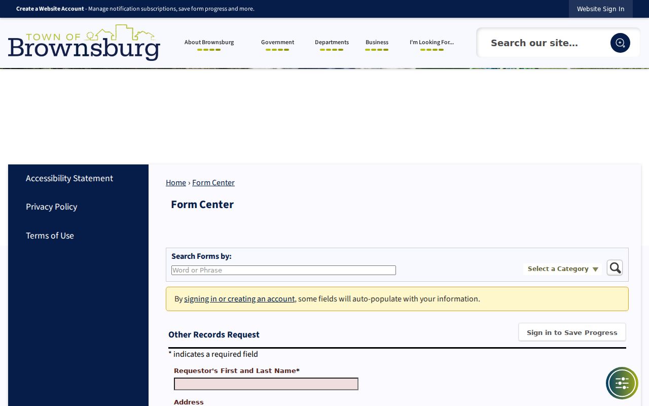
The form should be used for an existing, described record, not for a new roster of residents or private emergency details.
IndianaVoters can confirm one known person's registration with name, birth date, and Hendricks County. It has no block, street, ZIP, or radius search. A lawful county voter file request may have different terms under IC 3-7-27-6, with redactions and protected-voter rules. One voter result never describes every home nearby.
Brownsburg Neighbor Source Check
Official rolls and commercial neighbor tools should not be treated as equal. County and Town sources state the role, keeper, and record date. Commercial identity directories can merge prior addresses, marketing data, phone associations, and people with similar names. They may be stale or paywalled, and they do not replace a recorded deed or dated public file.
| Source type | Best use | Main limit |
|---|---|---|
| GIS and assessor | Parcel adjacency and owner of record | Owner is not necessarily occupant |
| Recorder and planning | Boundaries, declarations and public project history | Filing party may live elsewhere |
| Commercial directory category | Unverified starting lead only | Names and addresses may be merged or old |
Keep the official URL, retrieval date, parcel or document number, and stated coverage with each fact. If an official trail ends, use a targeted custodian request or state clearly that no result was found.
Brownsburg Neighbors and Privacy
A parcel map cannot identify every renter, family member, guest, child, utility customer, or protected voter. An owner may be an estate, trust, or company. Indiana's Address Confidentiality Program can substitute or shield an eligible participant's location. Restricted-address procedures and the federal Driver's Privacy Protection Act also bar attempts to obtain protected address data from motor-vehicle files.
Postal city, parcel situs, legal description, tax mailing address, and corporate limits are different fields. A Brownsburg mailing address can sit outside the town boundary. Mark that mismatch when it appears. Never use an old deed, voter record, court caption, or adjacent parcel to defeat a confidentiality marker.
Lawful use. Research Brownsburg neighbors for civic curiosity, reconnection, or personal safety. Never use public records to watch, harass, threaten, or expose anyone.